 ReddRadar
Top AI tools for Urban Planner
-
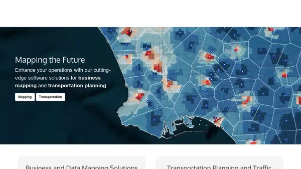 caliper.com Mapping the Future with Cutting-Edge Software Solutions
Caliper provides comprehensive mapping, GIS, and transportation software solutions for businesses and government agencies to analyze data, optimize operations, and plan strategically.
- Other
-
 eizen Your Intelligent Video AI Assistant
eizen offers an interactive AI video platform featuring intelligent assistants that analyze and provide guidance on visual content in real-time, alongside a no-code computer vision solution.
- Contact for Pricing
-
 ONEMOTOR Universal Electric Drive System for Bikes, Scooters, and Bikeshare
ONEMOTOR is a versatile electric drive system that attaches to any bike, scooter, or bikeshare platform, providing powerful motor assistance with minimal weight and easy installation.
- Other
-
 Skyline Spot Elevate Your Brand Above the Cityscape
Skyline Spot is an AI-powered urban advertising platform that revolutionizes brand visibility by integrating innovative displays with city skylines for maximum impact.
- Other
-
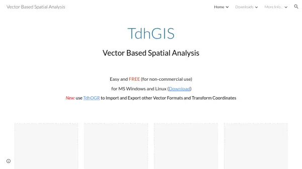 TdhGIS Free Vector-Based Spatial Analysis Software for Windows and Linux
TdhGIS is a free vector-based spatial analysis software for non-commercial use on Windows and Linux, offering tools for creating, editing, and analyzing geographic data with features like importing Shapefiles and OpenStreetMap data, allocating point and polygon data, and creating thiessen polygons and contours.
- Free
-
 Every Door The best OpenStreetMap editor for POIs and entrances.
Every Door is an open-source OpenStreetMap editor designed for mapping points of interest, entrances, and micro-mapping features with offline capabilities and AI-assisted data validation.
- Free
-
 NextGIS All-in-one GIS platform for maps and geodata
NextGIS provides comprehensive GIS solutions with web, mobile, desktop, and server tools for creating, managing, and sharing spatial data and interactive maps.
- Contact for Pricing
-
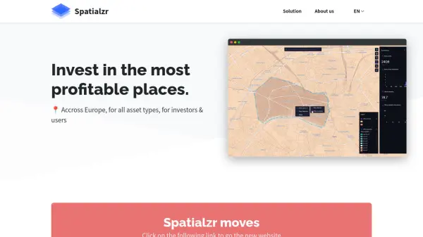 Spatialzr Invest in the most profitable places.
Spatialzr offers real-time market analysis and site selection algorithms for commercial real estate (CRE) across Europe, aiding investors and businesses in making informed location decisions.
- Paid
- From 216$
-
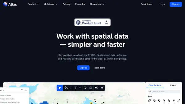 atlas.co Work with spatial data — simpler and faster
Atlas is a browser-based GIS platform designed to simplify the visualization, analysis, and building of spatial data workflows and web applications.
- Freemium
- From 23$
-
 Bird Electric Bikes and Scooters For Cities
Bird provides micro-electric mobility solutions including electric bikes and scooters to reduce traffic and promote cleaner air in urban environments.
- Contact for Pricing
-
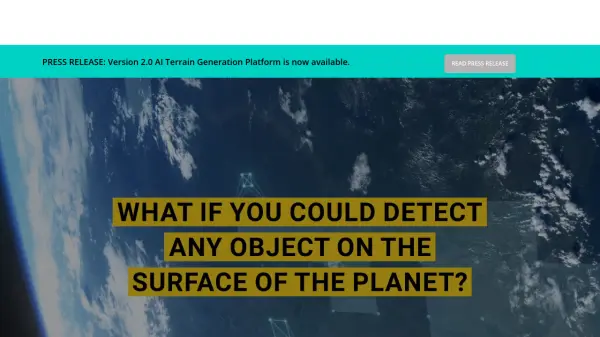 Blackshark.ai Real-time Semantic 3D Digital Twin of the Planet
Blackshark.ai generates a real-time, accurate, semantic, and photorealistic 3D digital twin of the entire planet using machine learning and satellite imagery. This technology supports various applications, including simulation, visualization, and geospatial analytics.
- Contact for Pricing
-
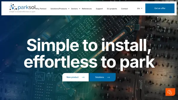 Parksol Simple to install, effortless to park
Parksol provides comprehensive parking management solutions including guidance systems, counting, signage, and monitoring software for various sectors worldwide.
- Contact for Pricing
-
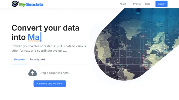 MyGeodata Converter Convert GIS and CAD data online with ease
MyGeodata Converter is an online tool for converting vector and raster GIS/CAD data between various formats and coordinate systems. It supports bulk conversions, CAD formats, and Google Earth output.
- Freemium
- From 10$
-
 Streetcar Live Track real-time streetcar locations and arrivals with live mapping
Streetcar Live is an AI-powered tool that provides real-time tracking and arrival information for streetcars, featuring live maps and historical vehicle details to enhance urban transit navigation.
- Free
-
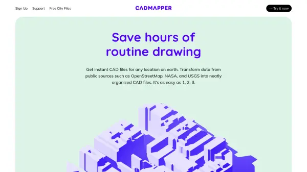 Cadmapper Get instant CAD files for any location on earth
Cadmapper transforms data from public sources like OpenStreetMap, NASA, and USGS into neatly organized CAD files, saving hours of routine drawing for designers, architects, and illustrators.
- Freemium
-
 Redraw Generate Realistic Renders in Under 30 Seconds with AI
Redraw is an AI-powered tool for architects, engineers, and designers to create realistic renders, generate design ideas, and enhance images quickly.
- Paid
- From 13$
-
 EOfactory Actionable geo-intelligence to ensure sustainability
EOfactory provides actionable geo-intelligence solutions using AI and ML for various industries, focusing on sustainability and science-based decisions. Access satellite imagery, process data, and visualize insights through custom dashboards.
- Free Trial
-
 Parking Logix Solutions for Safer, Smarter Parking Lots
Parking Logix provides AI-powered parking solutions including occupancy detection, real-time space guidance, data analytics, and wayfinding tools to optimize parking operations and enhance driver experience.
- Contact for Pricing
-
 Snaptrude Program to proposals at lightning speed with data-backed design concepts
Snaptrude is a web-based 3D modeling and space planning tool that enables architects and designers to create and validate design concepts quickly, complete with AI-powered rendering capabilities.
- Free Trial
-
 Happy Cities Creating happier, healthier, more inclusive communities through urban planning and design
Happy Cities is an urban planning, design, and research consultancy that works with governments, developers, and non-profits worldwide to design neighborhoods, public spaces, and housing that nurture wellbeing for all community members.
- Contact for Pricing
-
 quarter.nyc Instant Parking Booking Anytime, Anywhere
Quarter connects drivers with available parking spots nationwide, offering hourly to monthly reservations and secure, hassle-free transactions for both drivers and parking space hosts.
- Other
-
 Regrid Comprehensive parcel data with boundaries, buildings, addresses, and geographic enrichments for all your location decisions.
Regrid provides comprehensive parcel data for the U.S. and Canada, including boundaries, ownership, addresses, and geographic insights, accessible via app, data store, API, and enterprise solutions.
- Freemium
-
 xyzt.ai Turn your IoT data into actionable insights
xyzt.ai is a powerful platform that combines spatial and time series analysis to visualize and analyze spatio-temporal data from any source, regardless of size. It specializes in IoT, maritime, and mobility data analytics with GenAI-powered insights.
- Contact for Pricing
-
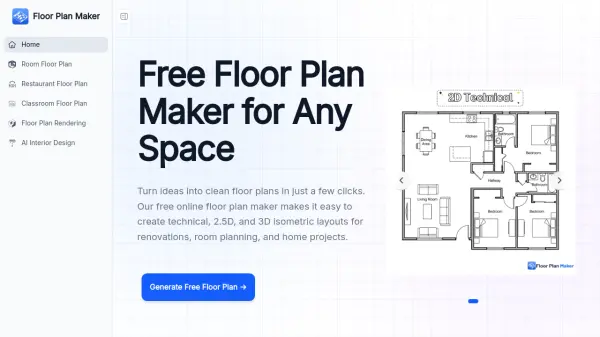 Floor Plan Maker Turn Ideas Into Clean Floor Plans in Just a Few Clicks
Floor Plan Maker is a free AI-powered online tool that generates technical, 2.5D, and 3D isometric floor plans for homes, apartments, and renovations in seconds — no design experience or sign-up required.
- Free
-
 Donkey Republic Rent a bike 24/7 with flexible, app-based mobility solutions
Donkey Republic provides an AI-driven bike-sharing platform that allows users to rent bicycles on-demand in multiple European cities through a mobile app, offering flexible pricing options including pay-per-ride, memberships, and day passes.
- Freemium
-
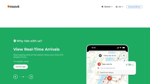 Moovit Plan, pay, and ride with the #1 mobility app
Moovit is the world's leading urban mobility app that helps users plan trips, view real-time arrivals, and book tickets across public transit systems in over 100 countries.
- Freemium
-
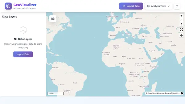 GeoVisualizer Advanced Web GIS Platform for Spatial Data Analysis
GeoVisualizer is an advanced web GIS platform that allows users to import, analyze, and export geospatial data with a variety of spatial analysis tools including buffer analysis, dissolve, centroids, grid generation, and more.
- Free
-
 Mapit GIS Mobile GIS for asset collection, GPS surveys, and field data management
Mapit GIS is a professional mobile GIS platform for iOS and Android that enables offline-first data collection, GPS surveys, and field data management with support for GeoPackage, multiple export formats, and sub-metre GNSS accuracy.
- Other
-
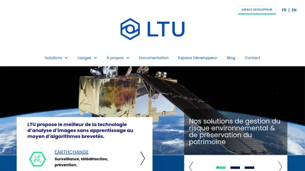 LTU Tech Advanced Visual Recognition and Image Analysis Solutions
LTU Tech leverages patented algorithms to deliver advanced image recognition, visual search, and risk management solutions across industries, enhancing operational efficiency and asset protection.
- Other
-
 Jain Housing Quality Real Estate Development Since 1987
Jain Housing is a real estate developer specializing in residential and commercial projects across major Indian cities, offering a range of properties from 1 BHK to 5 BHK apartments with a focus on eco-friendly living and customer satisfaction.
- Contact for Pricing
-
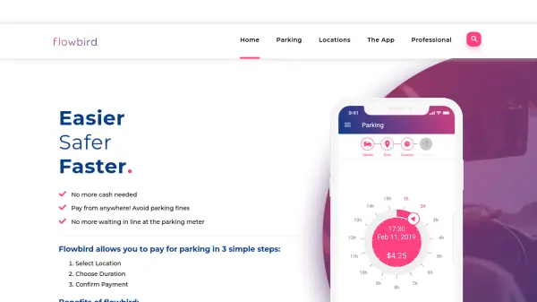 Flowbird Easier, Safer, Faster Parking Payments
Flowbird is a mobile and web app that enables users to pay for parking digitally in three simple steps: select location, choose duration, and confirm payment, eliminating the need for cash or physical meters.
- Other
-
 Pataa The New Language of Address!
Pataa is an advanced addressing solution that provides short, unique digital address codes to simplify long and complex addresses, enhancing delivery efficiency and customer experience.
- Free Trial
-
 Carta Maps Build Custom Interactive Maps with Ease
Carta Maps is an AI-powered platform for creating custom interactive maps with intuitive styling tools, real-time collaboration, and advanced features like geocoding, boundary finding, and drawing tools.
- Freemium
- From 9$
-
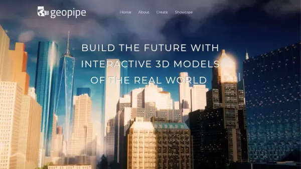 Geopipe Build the Future with Interactive 3D Models of the Real World
Geopipe uses AI to create interactive 3D models of real-world environments from sensor data. Stream vast digital twins directly into Unity, Unreal Engine, or download as 3D meshes for simulations, gaming, and VR experiences.
- Contact for Pricing
-
 CYLIND Top-tier Architectural Visualization Services for Architects and Real Estate Developers
CYLIND is a full-scope 3D architectural visualization studio that creates photorealistic renderings, animations, virtual tours, and floor plans to help architects and developers communicate designs effectively with stakeholders.
- Contact for Pricing
-
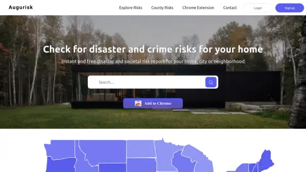 Augurisk Instant Disaster and Societal Risk Assessment
Augurisk provides instant and free disaster and societal risk reports for homes, cities, or neighborhoods in the United States.
- Freemium
- From 90$
-
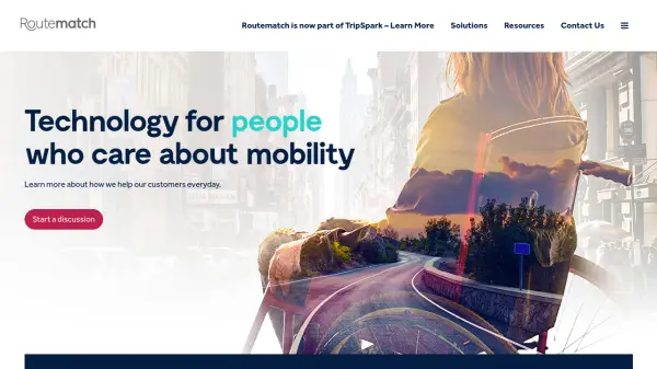 Routematch Technology for people who care about mobility
Routematch provides AI-powered transit solutions that connect transit agencies with riders through automated fare collection, fixed route optimization, demand response services, and mobility management.
- Contact for Pricing
-
 NYC Mesh Reliable community-owned internet for all New Yorkers
NYC Mesh is a volunteer-driven community network providing high-speed, reliable internet access to bridge the digital divide in New York City through rooftop antennas and fiber connections.
- Other
-
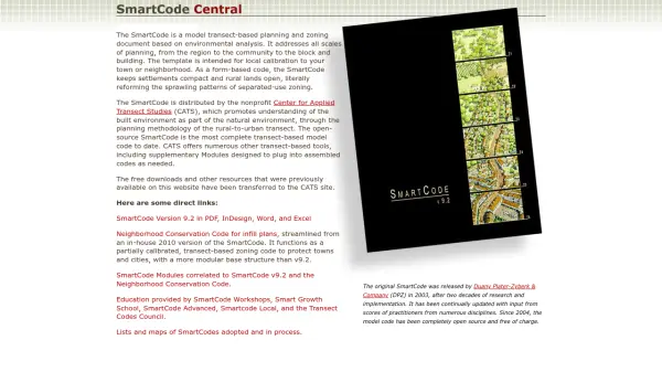 SmartCode Transect-based planning and zoning for sustainable development
SmartCode is an open-source, transect-based model code for planning and zoning that promotes compact settlements and preserves rural lands, addressing scales from region to building.
- Free
-
 SpatialPoint Location Intelligence for Powerful Business Decisions
SpatialPoint provides AI-powered location intelligence solutions including mapping, geocoding, address validation, and demographic analysis to solve complex business location challenges.
- Contact for Pricing
-
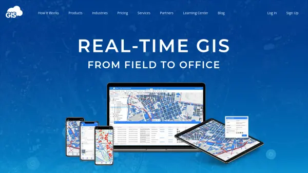 GIS Cloud Real-time GIS: From Field to Office
GIS Cloud is a fast and powerful online GIS platform for operations management, enabling field data collection, map editing, and real-time team collaboration across industries.
- Paid
- From 15$
-
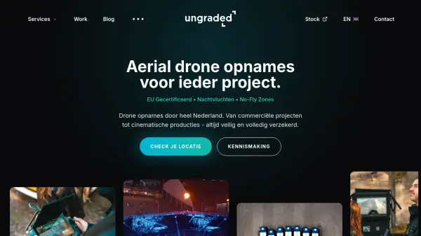 Ungraded Professional Drone Services for Aerial Video Production
Ungraded is a Dutch drone production company offering certified aerial drone recordings for commercial projects, real estate, and marketing with services including night flights and operations in no-fly zones.
- Contact for Pricing
-
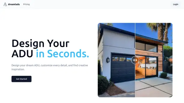 DreamLADU Design Your Accessory Dwelling Unit in Seconds
DreamLADU is an AI-powered platform that enables users to quickly design and customize their ideal Accessory Dwelling Unit (ADU), offering both creative inspiration and detailed personalization features.
- Freemium
- From 20$
-
 One One Six Apartments Luxury apartment living in Carmel, IN with modern designs and superb amenities
One One Six Apartments offers luxury apartment living in Carmel, Indiana, featuring modern floor plans, premium amenities, and a convenient location near local attractions.
- Contact for Pricing
-
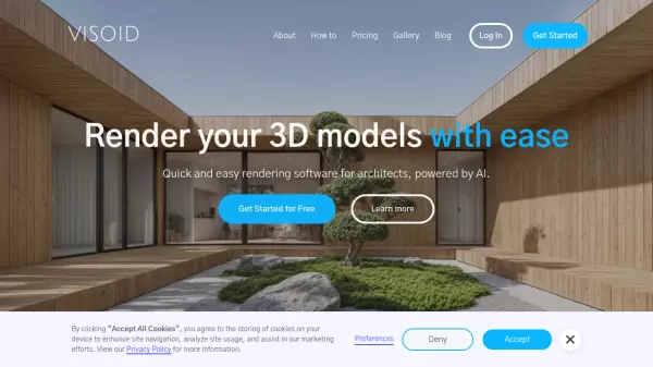 Visoid Quick and easy rendering software for architects, powered by AI
Visoid is an AI-powered 3D rendering software that enables architects to create high-quality visualizations in seconds, with support for any 3D design application and simple three-step workflow.
- Freemium
- From 29$
-
 Parkitect Build and manage the theme parks of your dreams with modern tycoon gameplay
Parkitect is a modern theme park tycoon game where players construct roller coasters, design immersive parks, and manage operations through challenging campaigns and multiplayer modes.
- Pay Once
-
 Runopt AI-powered software for land development delivering cost-effective, sustainable designs in minutes.
Runopt is an AI-powered software transforming land development by integrating design optimization for cost-effective, sustainable designs. It streamlines site analysis, grading, drainage, and reporting for civil engineers and developers.
- Contact for Pricing
-
 PlantMaster Streamline Landscape Plant Presentations and Reports
PlantMaster delivers robust plant database management and interactive presentation tools for landscape professionals, enabling effortless plant selection, customization, and project reporting.
- Free Trial
-
 Terrain Navigator Pro Generating work flow efficiency and increasing return on investment for today’s mapping professionals
Terrain Navigator Pro is a comprehensive mapping platform that combines topographic maps and aerial photos with powerful mapping tools for creating, editing, and synchronizing map projects across desktop, web, and mobile devices.
- Free Trial
-
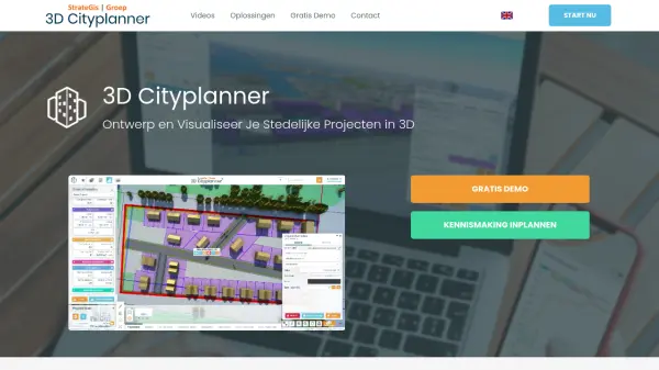 3D Cityplanner Design and Visualize Urban Projects with Smart 3D Planning
3D Cityplanner enables professionals to design, analyze, and visualize urban development projects using advanced data layers and AI-powered planning tools within a detailed 3D environment.
- Freemium
Featured Tools
Join Our Newsletter
Stay updated with the latest AI tools, news, and offers by subscribing to our weekly newsletter.
Didn't find tool you were looking for?