What is Leaflet?
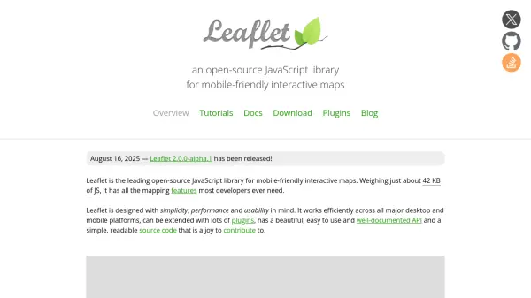
Leaflet is an open-source JavaScript library specifically designed for creating mobile-friendly interactive maps. Weighing approximately 42 KB of JavaScript, it provides all the essential mapping features most developers require while maintaining excellent performance across all major desktop and mobile platforms. The library focuses on making basic mapping functionalities work perfectly, offering out-of-the-box layers including tile layers, markers, popups, and vector layers like polylines and polygons.
The library features a beautiful, easy-to-use, and well-documented API with a simple, readable source code that encourages community contributions. It includes comprehensive interaction capabilities such as drag panning with inertia, scroll wheel zoom, pinch-zoom on mobile, and various event handling. Leaflet supports extensive customization through pure CSS popups and controls, custom map layers, and multiple map projections, while its modular build system allows developers to exclude unnecessary features for optimal performance.
Features
- Layers Out of the Box: Tile layers, WMS, markers, popups, vector layers (polylines, polygons, circles, rectangles), image overlays, and GeoJSON
- Interaction Features: Drag panning with inertia, scroll wheel zoom, pinch-zoom on mobile, double click zoom, zoom to area, keyboard navigation, and various event handling
- Visual Features: Zoom and pan animation, tile and popup fade animation, default design for markers and controls, and retina resolution support
- Customization Features: Pure CSS popups and controls for restyling, image- and HTML-based markers, custom map layers and controls, and support for custom map projections
- Performance Features: Hardware acceleration on mobile, CSS-optimized panning and zooming, smart polyline/polygon rendering with dynamic clipping, and modular build system
Use Cases
- Creating interactive maps for websites and web applications
- Developing mobile-friendly mapping solutions for various platforms
- Building custom map visualizations with specific styling requirements
- Implementing geographic data displays with markers and overlays
- Developing mapping applications with real-time interaction capabilities