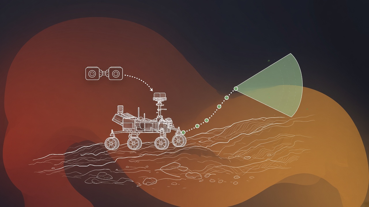
Mars rovers cannot be joysticked like remote cars. One-way light time between Earth and Mars averages about 14 minutes, so a command sent after seeing a hazard may arrive too late. Autonomous navigation (AutoNav) lets rovers classify terrain, plan paths around rocks and slopes, and execute drives between downlink sessions. NASA Perseverance used AutoNav for roughly 88 percent of the 17.7 kilometers traveled in its first Mars year, setting records including 699.9 meters in a single autonomous segment without human review and 347.7 meters in one sol. Enhanced Navigation (ENav) adds orientation-sensitive hazard assessment. The Vision Compute Element (VCE) FPGA processes 1280 by 960 stereo pairs in seconds versus about one minute on the Rover Compute Element. AEGIS targets interesting rocks for instrument study without waiting for Earth. Readers exploring AI research for robotics or popular AI tools for computer vision should compare AutoNav workflows across NASA missions to see how latency shapes architecture.
Earth-Mars Communication Delay
Radio signals take roughly 4 to 24 minutes one way depending on orbital geometry, making real-time teleoperation impossible and forcing onboard decision making for driving and science targeting. Operators upload activity plans during daily communication windows, then rovers execute autonomously until the next session. AutoNav fits between waypoints specified by humans: the rover chooses local detours, measures slip, and stops if uncertainty exceeds thresholds. Without autonomy, daily progress would be a few meters of blind execution rather than hundreds.
Bandwidth limits compound delay. Panoramic images and engineering telemetry compete for downlink; summarizing autonomy outcomes (path taken, hazards encountered) is more efficient than streaming every stereo frame to Earth. Machine learning compresses terrain assessment into compact hazard maps uplinked for human situational awareness.
Terrain Classification and Hazard Maps
Stereo vision and machine learning classify soil, bedrock, sand, and obstacles, building traversability maps where each cell receives a cost based on slope, rock height, and wheel slip history. Earlier missions used human-reviewed stereo correlation on Earth; Perseverance pushes more classification to onboard GPUs and FPGAs. ENav extends classic Nav by evaluating hazards relative to rover heading, penalizing side slopes that could tip the vehicle even when forward cells look flat. Sand traps that trapped Spirit remain a lesson encoded in slip models and conservative speed limits.
| Mission | Autonomy highlight | Notable metric |
|---|---|---|
| Spirit / Opportunity | Human-in-loop AutoNav pioneers | Tens of meters per sol typical |
| Curiosity | Mature AutoNav, slip checks | Kilometers over mission life |
| Perseverance | ENav, VCE stereo, high AutoNav fraction | 699.9 m record autonomous segment |
| Perseverance AEGIS | Autonomous science targeting | Selects rocks for ZAP / cache |
Path Planning and AutoNav Workflows
Given a goal waypoint, the rover generates local paths with A-star or similar search on traversability grids, simulates body clearance over rocks, and executes short segments with visual odometry to correct drift. AutoNav loops: acquire stereo, update map, plan, drive a few meters, repeat. If predicted slip exceeds limits, the rover stops and waits for operator guidance in the next plan. Perseverance's 88 percent AutoNav fraction for 17.7 km in year one shows operators trust the stack for routine traverse between science stations. The 347.7 meter single-sol record demonstrates cumulative gains when compute and ENav policies align with favorable terrain.
Human operators set no-go zones around delicate hardware (sample tubes, helicopter pads) and high-value science targets. Autonomy respects those polygons while optimizing route length and energy. Future sample return missions may require even longer autonomous relays between depot sites, pushing planners toward learned policies trained in high-fidelity Mars simulators.
VCE FPGA Stereo Processing
The Vision Compute Element accelerates stereo correlation and obstacle detection on dedicated FPGA hardware, cutting per-frame latency from about one minute on the main Rover Compute Element to seconds at 1280 by 960 resolution. Faster perception enables more replanning cycles per sol, directly increasing distance. Radiation-hardened FPGAs trade programmability for throughput; algorithms must map efficiently to fixed pipelines. When VCE is unavailable, the rover falls back to slower paths with reduced daily range, illustrating hardware-software co-design importance.
Stereo baseline and calibration drift with temperature swings on Mars. Autonomous navigation pipelines include online calibration checks using visual odometry residuals. Dust on camera windows degrades contrast; ENav incorporates confidence masks so low-texture regions do not falsely appear safe.
AEGIS Science Targeting
Autonomous Exploration for Gathering Increased Science (AEGIS) ranks rocks in panoramic images by geologic interest, choosing targets for ChemCam laser shots or contact instruments without waiting for Earth to pick coordinates. AEGIS uses texture, color, and shape features tuned by science team weights. It multiplies science return per sol when drives place the arm workspace over diverse materials. AI Mars rover navigation and AI science targeting share perception stacks but differ in decision horizons: driving cares about wheel-scale hazards; AEGIS cares about centimeter-scale features in reach.
Ethical and planetary protection constraints limit autonomy near biologically sensitive sites if life detection were positive; current rules focus on geological diversity. Open-loop autonomy logs every decision for post-sol replay on Earth, supporting algorithm updates for subsequent missions.
Drive software executes in layers: strategic plans from Earth specify sol goals; tactical autonomy chooses local routes; low-level motor controllers handle wheel torques and steering angles. Slip estimation compares visual odometry to expected motion; high slip triggers stops before embedding wheels in soft sand as Spirit experienced. Perseverance's record 699.9 meter autonomous segment without human review demonstrates trust in layered checks, not blind speed maximization. Each segment ends with telemetry bundles operators replay before authorizing longer segments next sol.
Stereo vision on Mars differs from terrestrial robotics: thin atmosphere reduces scattering but dust storms lower contrast. Camera calibration drifts with daily temperature swings of tens of degrees Celsius. ENav orientation-sensitive hazard maps penalize traversing across slopes that could tip the rover even when forward cells appear flat. Combined with AutoNav, ENav contributed to the 88 percent autonomous fraction over 17.7 kilometers in Perseverance's first Mars year, a metric operators track alongside distance records.
VCE FPGA acceleration at 1280 by 960 resolution in seconds versus about one minute on RCE is not a convenience feature; it determines how many replanning cycles fit inside energy and thermal budgets per sol. More perception frames per meter traveled means earlier detection of rocks that exceed ground clearance. When VCE is offline, fallback modes reduce daily range, illustrating hardware-software codesign constraints flight projects manage years before launch.
AEGIS science targeting selects rocks for instrument study based on texture, color, and shape rankings tuned by the science team. It shares perception with navigation but optimizes for centimeter-scale features within the arm workspace rather than meter-scale wheel hazards. Autonomous science multiplies return when drives place diverse materials within reach without waiting for Earth to pick pixel coordinates. Combined with sample caching, AEGIS influences which materials may eventually return to Earth for laboratory analysis.
Future missions toward sample return depots or human landing sites will demand longer autonomous relays between stations. Simulation environments on Earth replicate Mars lighting and soil mechanics to train learned traversability costs before flight software certification. The fourteen minute average Earth-Mars delay will not shrink; autonomy must grow. Comparing Spirit, Opportunity, Curiosity, and Perseverance shows steady expansion of trusted AutoNav fraction as compute and algorithms mature.
Frequently Asked Questions
Can Perseverance drive without humans?
It drives autonomously between human-approved waypoints. Operators set goals and constraints daily; AutoNav handles local paths. Catastrophic hazard scenarios still favor conservative stops pending review.
What is ENav?
Enhanced Navigation evaluates hazards relative to rover orientation, improving side-slope and clearance assessment compared to earlier AutoNav versions on Curiosity.
How fast is VCE stereo?
Reported processing of 1280 by 960 stereo in seconds versus about one minute on RCE, enabling more frequent map updates during drives.
Does autonomy use deep learning?
Missions combine classical geometry, hand-tuned classifiers, and increasingly learned components where validation on Earth analog sites supports flight software certification. Not every step is a neural network.
What limits drive distance?
Energy, terrain, slip, communication windows, and thermal constraints. AutoNav removes the teleoperation bottleneck but not physics or power budgets.
Will future rovers be more autonomous?
NASA and ESA roadmaps emphasize longer traverses, cooperative drones, and sample relay. Expect more onboard compute and learned traversability models validated in simulation-to-real transfer pipelines.
Comparing missions clarifies progress: Spirit and Opportunity proved stereo could work with heavy Earth review; Curiosity scaled AutoNav kilometers; Perseverance combines ENav, VCE speed, and AEGIS science. The 14 minute delay is not shrinking; autonomy must grow. Researchers in AI research test Mars-analog rovers in deserts with similar workflows, feeding algorithms that may fly on Mars Sample Return escorts or European ExoMars successors.
Record drives make headlines, but reliability metrics matter more: fraction of sols where autonomy completes without intervention, distribution of slip events, and false hazard stops. Operators tune thresholds using downlinked summaries rather than raw stereo floods. As compute budgets rise, expect tighter integration between navigation and instrument placement so the rover drives to the most informative rock, not merely the nearest waypoint along a human-drawn polyline.
Helicopter scouts such as Ingenuity extended Perseverance planning by imaging terrain ahead of long drives, though rotorcraft autonomy is a separate stack from wheeled AutoNav. Future combined missions may fuse aerial maps with ground stereo for faster hazard updates across kilometers of ridgelines. Machine learning on Earth analog rover campaigns in deserts and lava fields feeds algorithms tested years before launch locks flight software branches.
Radiation-hardened processors limit model size compared to terrestrial GPUs, so flight teams favor efficient architectures validated through exhaustive simulation. A false hazard stop costs a sol; a missed rock costs a wheel. Conservative thresholds reflect asymmetric risk. Downlinked autonomy logs enable post-sol replay on Earth clusters where larger models prototype improvements for subsequent software uploads during extended missions lasting many years.
Wheel wear monitoring complements vision-based navigation: torque trends signal when bedrock contact increases even if stereo maps look traversable. Perseverance software fuses engineering telemetry with visual slip estimates before authorizing longer AutoNav segments. That multimodal fusion mirrors terrestrial off-road autonomy but under severe bandwidth and compute caps imposed by interplanetary flight heritage requirements.
Sample tube depot sites planned for Mars Sample Return will require repeated precise approaches across multiple sols. Autonomous navigation must stop within centimeters of known landmarks while avoiding fresh sand deposits not present in older orbital maps. High-resolution orbital updates from reconnaissance cameras onboard the rover refine long-baseline plans between human waypoints, closing the loop between orbital and ground-scale AI perception.
Nighttime thermal constraints limit how long stereo cameras can operate before heaters draw excessive power. Autonomy schedules drives during daylight windows when texture supports visual odometry, pacing distance goals against energy budgets that also feed spectrometers and communication relays. Operators trade traverse distance against instrument time; AutoNav efficiency directly returns hours to science teams that would otherwise be lost to cautious single-step human-reviewed hops.