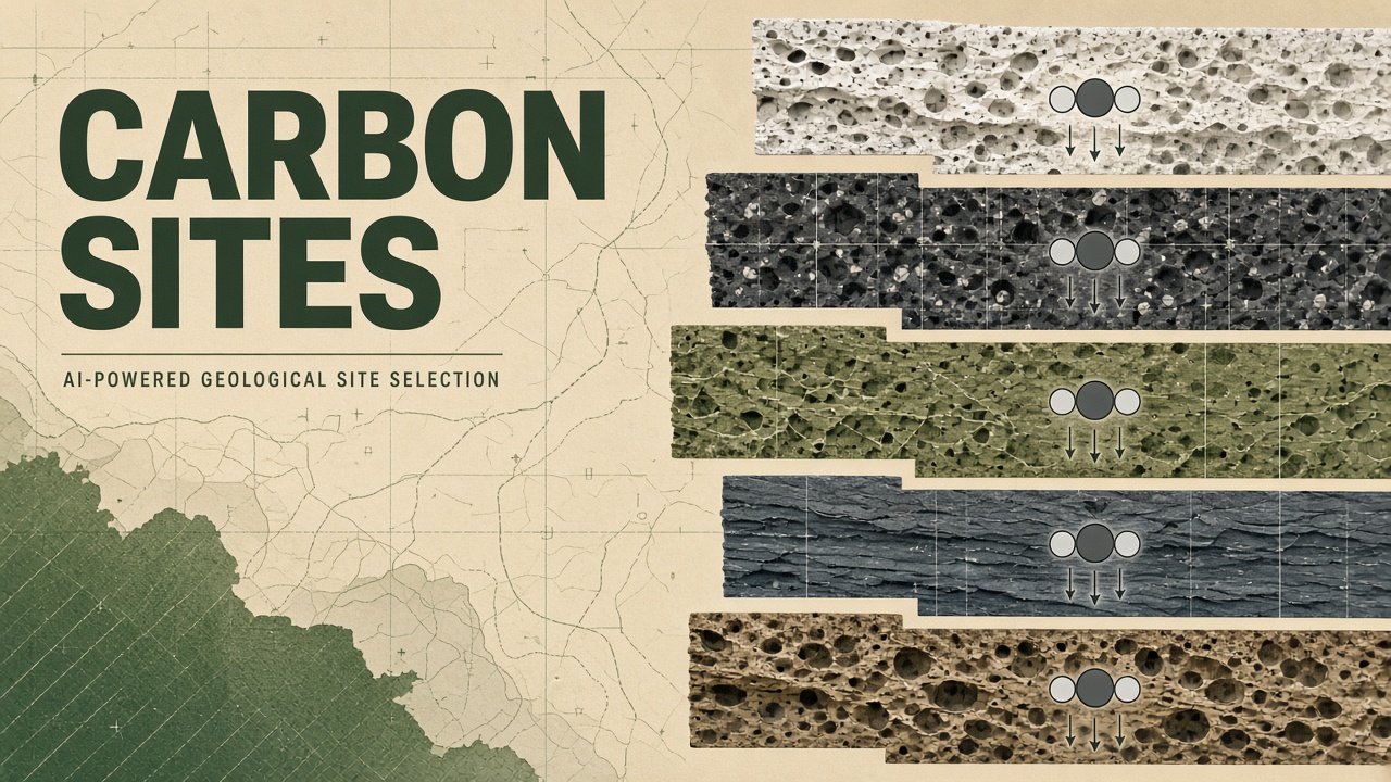
Carbon capture and storage (CCS) projects fail or stall when site selection skips a fault line, underestimates caprock integrity, or ignores community opposition. Geologists traditionally screen basins with manual GIS overlays and expert judgment, a slow process when governments need gigaton-scale sequestration roadmaps. Carbon sequestration site selection AI applies deep neural networks and multi-criteria decision models to rank onshore and offshore reservoirs, balancing storage capacity, injectivity, risk, and infrastructure proximity.
Energy majors, state geological surveys, and carbon removal startups all ask the same question: where can CO2 stay underground for centuries? Product teams exploring AI chatbot interfaces for energy transition workflows should ground answers in published screening methodologies, not invented reservoir rankings. More explainers live on the EliteAI.tools blog index.
What Carbon Sequestration Site Selection AI Means in Plain Language
Carbon sequestration site selection AI is the use of machine learning and GIS analytics to score geological formations, land parcels, and offshore leases for safe long-term CO2 storage based on porosity, permeability, caprock thickness, depth, faults, and economic access. Site selection is not the same as project development: screening narrows thousands of polygons to dozens of candidates worthy of seismic surveys, appraisal wells, and permitting studies costing millions of dollars each.
AI accelerates pattern recognition across raster and vector geospatial layers. A deep neural network (DNN) trained on labeled suitable and unsuitable sites learns nonlinear combinations of slope, distance to pipeline, soil type, and aquifer proximity that logistic regression misses. Offshore CCUS adds bathymetry, seabed temperature, and well integrity datasets from decades of oil and gas drilling.
| Criterion | Why it matters | Typical data source |
|---|---|---|
| Storage capacity | Pore volume available for CO2 | Seismic interpretation, well logs |
| Caprock integrity | Prevents upward migration | Shale thickness maps, fault databases |
| Injectivity | Flow rate without fracturing caprock | Permeability models, pressure tests |
| Accessibility | Pipeline, port, emitter distance | Infrastructure GIS, shipping lanes |
How the Site Selection Pipeline Works
A carbon sequestration site selection pipeline compiles geological and socio-environmental GIS layers, labels historical successful and failed projects, trains ML classifiers or regressors, ranks candidate polygons, and subjects top tiers to expert review and sensitivity analysis. Multi-criteria decision analysis (MCDA) often wraps ML outputs so stakeholders weight social risk alongside porosity.
GIS plus ML deep neural networks onshore
Published GIS+ML workflows stack dozens of raster layers (elevation, lithology, land use, protected areas) and train deep neural networks to classify parcel suitability. Reported precision reaches 96.4% on hold-out test polygons in some regional studies, indicating the model rarely flags clearly unsuitable land as good. High precision reduces wasted field campaigns but must be paired with recall checks so rare high-capacity traps are not missed.
Offshore CCUS deep neural networks
Offshore carbon storage reuses depleted oil and gas reservoirs and saline aquifers beneath the continental shelf. DNN models ingesting seismic attributes, well completion records, and bathymetry predict storage potential with coefficient of determination (R2) up to 0.9937 in published Gulf-facing studies, meaning predicted capacity tracks expert labels closely on training basins. Offshore screening must also model platform reuse, CO2 shipping corridors, and monitoring with ocean bottom seismometers.
NETL CSIL multi-criteria Gulf of Mexico screening
The U.S. National Energy Technology Laboratory (NETL) Carbon Storage Infrastructure Logistics (CSIL) program applies multi-criteria screening across the Gulf of Mexico, integrating storage resource estimates, existing pipeline networks, and industrial CO2 source clusters. While not purely neural, CSIL exemplifies the structured decision layer AI outputs feed: ranked storage fairways linked to capture facilities and transport corridors, informing Department of Energy funding priorities.
Monitoring and verification planning during screening
Site selection should score monitoring feasibility alongside geology. A high-capacity saline aquifer beneath sensitive farmland fails if baseline seismic monitoring cannot detect micro-injection leaks. AI ranking layers increasingly include distance to existing observation wells, suitability for distributed acoustic sensing along legacy pipelines, and InSAR coherence for surface deformation tracking. Screening out sites that cannot support Class VI permit monitoring plans saves regulators and developers from expensive dead ends after preliminary geological enthusiasm.
Direct air capture and biomass hub siting
Direct air capture (DAC) and bioenergy with CCS (BECCS) hubs need geology near renewable power and biomass supply chains, not only near coal plants. GIS+ML models add layers for wind capacity factor, rail access to forestry residues, and freshwater availability for amine regeneration. Offshore DNN capacity maps help DAC developers evaluate shipping CO2 to saline formations when onshore community opposition blocks pipelines. Hub siting is inherently multi-objective; AI supplies consistent first-pass rankings that human planners refine in stakeholder workshops.
- Compile geological GIS layers (formation depth, thickness, porosity proxies).
- Add exclusion zones (faults, seismic risk, protected habitat, population density).
- Label training sites from expert assessments and pilot project outcomes.
- Train DNN or ensemble classifiers with spatial cross-validation.
- Rank candidate polygons; export uncertainty and feature importance maps.
- Run MCDA workshops with regulators, communities, and emitters before appraisal drilling.
Published Evidence and Industry Deployments
Academic and national lab studies report high precision and R2 on retrospective datasets, but prospective drilling validation remains the real test few AI papers yet complete. GIS+ML DNN precision of 96.4% suggests automated screening can shrink desktop study areas dramatically. Offshore DNN R2 of 0.9937 indicates learned models capture most variance in expert capacity labels when trained on dense well control in the Gulf of Mexico.
NETL CSIL multi-criteria Gulf screening operationalizes national strategy: linking storage fairways to petrochemical clusters along the Texas and Louisiana coast. Industry consortia (OGCI, PCI) use similar frameworks internally, sometimes augmented with proprietary seismic reprocessing not visible in open literature.
Direct air capture hubs and biomass CCS projects increasingly request AI-ranked land early in fundraising. Investors should demand confusion matrices disaggregated by geology province, not single global accuracy metrics that hide failure modes in untested formations.
Regulatory and permitting context
U.S. Environmental Protection Agency Class VI permits, EU CCS directives, and emerging national frameworks require detailed site characterization that AI cannot shortcut. Desktop screening narrows where companies spend on 3D seismic, appraisal wells, and geomechanical modeling for caprock integrity. State geological surveys publishing AI-ranked fairways accelerate public transparency but do not replace environmental impact review. Permit timelines measured in years mean today's 96.4% precision map is a starting hypothesis, not a storage complex ready for injection.
Limits, Risks, and Ethical Guardrails
Site selection AI trained on oil and gas provinces may overfit legacy well patterns and under-rank novel basalt mineralization or saline aquifers with sparse well control. A 96.4% precision figure computed on spatially autocorrelated polygons can inflate optimism if test folds leak neighboring geology.
- Data sparsity: Many promising regions lack well logs; models extrapolate blindly.
- Induced seismicity: Injectivity maps rarely predict earthquake risk from basement faults.
- Groundwater conflict: Saline aquifers may connect to USDWs if faults are mis-mapped.
- Community consent: High geological score does not equal social license to operate.
- Greenwashing: Ranked sites on a map do not imply financed capture plants exist.
Ethical guardrails require public disclosure of exclusion criteria, engagement with landowners and Tribal nations before leasing, independent geomechanical review before injection permits, and monitoring plans (pressure, tracers, satellite surface deformation) baked into selection scores. AI should flag environmental justice overlays so sequestration does not concentrate in marginalized counties solely because geology and low land cost align.
International CCS deployment adds cross-border pipeline and seabed treaty complexities that desktop GIS models must flag early. Storage fairways spanning state or national boundaries require harmonized regulatory frameworks before appraisal wells drill. AI screening layers that encode jurisdictional boundaries and existing treaty obligations help developers avoid ranking sites that look geologically ideal but face insurmountable legal fragmentation.
Who Should Use This and Who Should Wait
State geological surveys, CCS hub developers with seismic budgets, and national labs planning transport corridors should adopt GIS+ML screening to narrow search spaces now. Land speculators and carbon credit traders without appraisal wells should not treat AI rankings as proven storage volumes.
| Audience | Recommendation | Caveat |
|---|---|---|
| State geological survey | Deploy GIS+ML DNN regional screening | Use spatial cross-validation |
| Offshore CCS developer | Combine DNN capacity models with NETL-style MCDA | Validate R2 on held-out blocks, not random wells |
| Industrial emitter | Use national screening to locate hub partnerships | Permitting timeline exceeds map ranking |
| Carbon offset buyer | Wait for drilled and monitored projects | Desktop AI scores are not verified tonnes |
Frequently Asked Questions
What does 96.4% precision mean in GIS+ML site selection?
It means when the DNN labels a parcel as suitable, that label is correct about 96.4% of the time on the study's test split; it does not mean 96.4% of all land is storage-ready or that capacity volumes are confirmed. Report recall and prospective drilling outcomes alongside precision.
How reliable is offshore DNN R2 of 0.9937?
R2 near 0.9937 indicates the model explains most variance in expert-labeled storage potential on densely drilled offshore training data, likely Gulf of Mexico fairways. Transfer to frontier basins without wells will perform worse until local labels exist.
What is NETL CSIL Gulf of Mexico screening?
NETL's Carbon Storage Infrastructure Logistics program multi-criteria ranks Gulf storage resources against CO2 source clusters and pipeline logistics to guide national CCS infrastructure planning. It complements ML layers with engineering economics.
Can AI replace geologists in site selection?
AI narrows search areas and highlights feature combinations; licensed geologists and reservoir engineers still must interpret seismic, drill appraisal wells, and sign permit applications. Treat AI as triage, not sign-off.
Is onshore or offshore AI screening more mature?
Offshore benefits from decades of oil and gas well control enabling high R2 DNN models; onshore saline aquifers often lack labels, making GIS+ML precision metrics more variable. Maturity follows data density, not inherent geology quality.
Can communities veto AI-ranked sites?
Yes. Social license, land tenure, and environmental justice considerations can disqualify geologically favorable sites regardless of model score. MCDA workshops should run before leasing, not after.
Conclusion
Carbon sequestration site selection AI compresses years of desktop GIS work into ranked candidate maps, with published GIS+ML DNN precision at 96.4%, offshore CCUS DNN R2 up to 0.9937, and NETL CSIL multi-criteria Gulf of Mexico screening linking storage to infrastructure. The methods excel where well and seismic data are rich and falter where labels are sparse or community consent is ignored. Use AI to prioritize seismic and appraisal spending, validate with spatially honest cross-validation, and never confuse a heat map with a permitted storage complex ready to receive CO2.