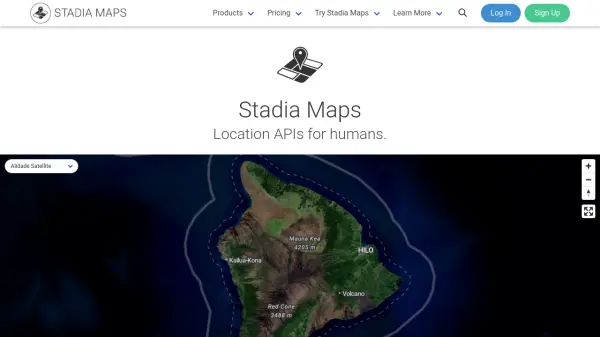
What is Stadia Maps?
Stadia Maps is a comprehensive geospatial platform that empowers organizations to seamlessly integrate high-quality location-based features into their digital products. The platform offers a wide array of mapping solutions including interactive basemaps, static maps, customizable styles, and up-to-date satellite imagery, catering to diverse business needs across logistics, real estate, travel, and more.
With a focus on privacy and reliability, Stadia Maps provides advanced APIs for geocoding, routing, navigation, and spatial analytics such as isochrone generation and matrix routing. Developers benefit from flexible SDKs for major languages and mapping libraries, as well as detailed documentation and responsive human support. Stadia Maps' transparent pricing model ensures predictable billing and scalability without surprises, making it a preferred alternative to major map providers.
Features
- Interactive Basemaps: Dynamic maps for web and mobile applications with multiple styles.
- Static Maps: Non-interactive map images for websites, emails, or apps.
- Custom Map Styles: Tailor map appearance to fit branding and context.
- Satellite Imagery: High-resolution, frequently updated satellite and aerial views.
- Geocoding APIs: Autocomplete search, forward/reverse geocoding, structured/bulk geocoding, and place lookup.
- Routing & Navigation: Turn-by-turn directions, matrix routing, optimized routes, map matching, and isochrones.
- Time Zone & Elevation Data: Access time zone information and elevation for any location.
- Official SDKs: Integration libraries for JavaScript, TypeScript, Python, Kotlin, Swift, and PHP.
- On-Prem & Embedded Solutions: Deploy mapping services in self-hosted or embedded environments.
- Transparent Billing: Fixed, usage-based pricing with a credit system to avoid surprise costs.
Use Cases
- Integrating interactive maps into business web and mobile applications.
- Adding location search and autocomplete functionality to e-commerce and travel websites.
- Enhancing logistics platforms with optimized routing and real-time navigation.
- Generating static maps for email campaigns, reports, or brochures.
- Analyzing geographic reach using isochrone maps for delivery or service areas.
- Deploying privacy-focused geospatial solutions for regulated industries.
- Visualizing real estate listings with custom map styles and satellite imagery.
- Building travel platforms with multi-modal directions and time zone data.
FAQs
-
What is the difference between the Free and Paid plans?
The Free plan offers up to 200,000 credits per month with access to basic APIs and standard basemaps for non-commercial use, while paid plans such as Starter, Standard, and Professional provide higher credit limits, access to additional APIs and satellite imagery, support for commercial use, and additional features. -
Can I switch from other map providers like Google Maps or Mapbox?
Yes, Stadia Maps supports users transitioning from Google Maps and Mapbox, offering comparable APIs and migration guides to simplify the switch. -
Does Stadia Maps offer support for on-premises or embedded solutions?
Yes, Stadia Maps provides on-premises hosting and embedded geospatial solutions for organizations with specific data control or privacy requirements. -
Do I need to provide a credit card to use the 14-day trial?
No, you can access the 14-day trial for all features without providing a credit card. After the trial, your account stays on the free tier unless you decide to upgrade.