
Pix4D - Alternatives & Competitors
Professional photogrammetry and 3D mapping solutions for digitizing reality
Pix4D provides advanced photogrammetry software and cloud solutions for creating accurate 2D maps, 3D models, and point clouds from drone and terrestrial imagery, serving industries like surveying, construction, agriculture, and public safety.

Ranked by Relevance
-
1
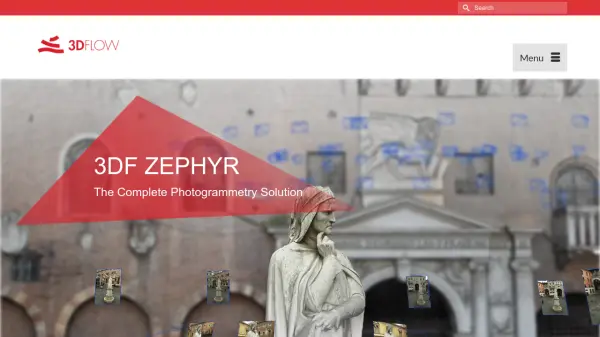 3DF Zephyr The Complete Photogrammetry Solution
3DF Zephyr is an all-in-one photogrammetry software suite that automatically reconstructs 3D models from photos and videos, supporting various cameras and sensors for applications in surveying, construction, cultural heritage, and more.
- Other
-
2
 Polycam 3D scanning platform - Digitize spaces and objects with precision
Polycam is a comprehensive 3D scanning platform that enables users to create, measure, and share 3D models of spaces and objects using LiDAR, photogrammetry, and 360-degree imaging technologies.
- Freemium
- From 25$
-
3
 Artec 3D Professional 3D scanning solutions revolutionizing workflows across industries
Artec 3D provides advanced 3D scanning technology and software solutions for industrial, medical, scientific, and creative applications, offering metrology-grade accuracy and intuitive workflows.
- Contact for Pricing
-
4
 GeoSurvey Professional Land Surveying and 3D Laser Scanning Services
GeoSurvey provides comprehensive land surveying and 3D laser scanning services with over 10,000 surveys completed since 1996, serving commercial, construction, and residential markets.
- Contact for Pricing
-
5
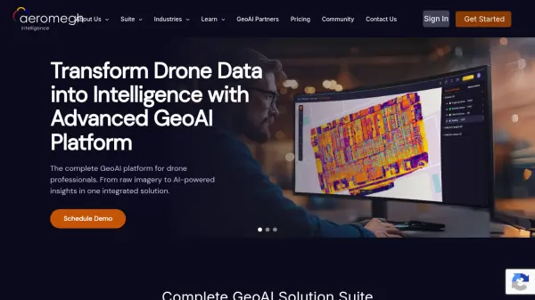 AeroMegh Transform Drone Data into Intelligence with Advanced GeoAI Platform
AeroMegh is a comprehensive GeoAI platform for drone professionals, offering photogrammetry, AI-powered object detection, and geospatial analytics in one integrated solution.
- Freemium
- From 47$
-
6
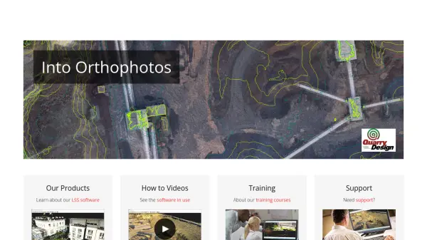 LSS Industry Leading Digital Terrain Modelling System for Surveying and Design
LSS is a comprehensive land survey and terrain modelling software used for converting point clouds into orthophotos, generating DTMs from LiDAR, and performing topographical surveys, design, and visualisation tasks.
- Other
-
7
 TopoExport Download 2D maps and 3D models in record time, anywhere in the world.
TopoExport is an AI-powered platform that enables professionals to quickly export customizable 2D topographic maps and 3D terrain models in various vector formats for architecture, urban planning, and design projects.
- Freemium
-
8
 MagiScan 3D Scanner App Powered by AI to Digitize Anything
MagiScan is a professional AI-powered 3D scanning application that converts photos into high-quality 3D models, supporting multiple export formats and offering both consumer and business solutions.
- Free Trial
-
9
 OpalAI Transforming spatial data into actionable insights with intelligent analysis
OpalAI is an advanced AI platform that converts spatial, visual, and point cloud data into detailed 3D models, BIM (Building Information Models), and actionable insights for various industries.
- Usage Based
- From 1$
-
10
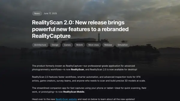 RealityCapture Create realistic 3D models from photos
RealityCapture is a photogrammetry software that enables users to create realistic 3D models from photos and laser scans for various applications.
- Paid
-
11
 3D Inspection Systems Efficient Inspection Reporting for Property Professionals
3D Inspection Systems offers robust and flexible inspection reporting software for home, building, marine, and environmental professionals, streamlining the creation of detailed inspection documents.
- Paid
-
12
 PixPlant Automated Creation of Seamless Tiling 3D Materials from Photos
PixPlant automates the process of creating seamless tiling PBR materials and 3D texture maps from real-world photos, saving time for professionals in texturing, design, and game development.
- Paid
-
13
 Datum Workstation Advanced Geospatial Analysis and Image Processing Software
Datum Workstation delivers professional GIS, image processing, and terrain analysis solutions, integrating advanced tools for managing, visualizing, and publishing geospatial data on Windows and MacOS platforms.
- Contact for Pricing
-
14
 Terrain Navigator Pro Generating work flow efficiency and increasing return on investment for today’s mapping professionals
Terrain Navigator Pro is a comprehensive mapping platform that combines topographic maps and aerial photos with powerful mapping tools for creating, editing, and synchronizing map projects across desktop, web, and mobile devices.
- Free Trial
-
15
 Concept3D Bring Experiences to Life with Immersive Digital Solutions
Concept3D provides a suite of AI-powered solutions including interactive maps, 360° tours, event calendars, and room reservation software to help organizations create immersive digital experiences for navigation, discovery, and engagement.
- Contact for Pricing
-
16
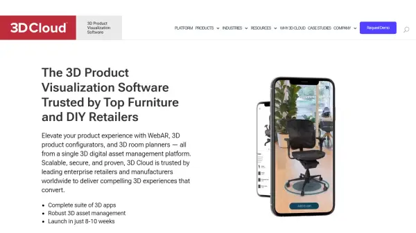 3D Cloud The 3D Product Visualization Software Trusted by Top Furniture and DIY Retailers
3D Cloud is an enterprise-grade 3D product visualization platform offering WebAR, 3D product configurators, and 3D room planners for furniture, kitchen, bath, office, and outdoor industries, helping retailers create compelling 3D experiences that boost conversions.
- Contact for Pricing
Didn't find tool you were looking for?