What is Bee Maps?
Bee Maps provides advanced solutions leveraging artificial intelligence for fleet management and geospatial data analysis. It offers tools designed to optimize fleet operations through AI-driven routing, cost-saving strategies, and continuous, real-time vehicle monitoring. The platform emphasizes efficiency and provides actionable insights without requiring long-term contracts or recurring subscription fees for some of its offerings.
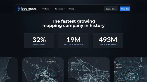
Alongside its fleet management capabilities, Bee Maps supplies high-definition map data, refreshed significantly more frequently than traditional sources. This includes detailed street-level imagery, static map features (like parking signs, speed limits, traffic lights), dynamic features (such as roadwork, gas prices), AI-detected driver events (harsh braking, collisions), and comprehensive HD map elements, accessible via various APIs for integration into existing systems.
Features
- AI-Powered Routing: Optimizes routes for efficiency and cost savings.
- Real-Time Fleet Monitoring: Provides live visibility into vehicle location and status.
- Cost-Saving Optimizations: Identifies opportunities to reduce operational expenses.
- Hyper-Fresh Map Data: Access HD maps and features refreshed frequently.
- Map Image API: Delivers fresh, global street-level imagery.
- Map Features API: Provides access to static map features like signs, signals, and restrictions.
- Dynamic Features API: Offers real-time insights into changing road conditions like roadwork or fuel prices.
- AI-Detected Driver Events: Captures and visualizes driving events like harsh braking or collisions.
- HD Map Elements: Provides accurate road and lane insights for advanced applications.
Use Cases
- Optimizing delivery routes for logistics companies.
- Monitoring vehicle fleets for operational efficiency.
- Enhancing navigation systems with fresh map data.
- Analyzing driver behavior for insurance risk assessment.
- Supporting urban planning with up-to-date infrastructure data.
- Providing detailed location imagery for real estate analysis.
- Training autonomous vehicle models with specific driving event data.