Coral reefs face sustained pressure from warming oceans, acidification, and local stressors. Field teams cannot manually label every benthic square meter across thousands of sites. An AI coral reef monitoring workflow turns underwater photos from trained divers into structured health metrics: live coral cover, bleaching prevalence, algae dominance, and key indicator species. Platforms like CoralNet and programs like Reef Check established the human-labeled training data that modern models extend. Teams exploring AI image generator tooling for outreach visuals and AI research infrastructure for model training share a common requirement: expert validation before numbers reach policymakers.
Why Diver Photos Became the Data Layer
Standardized diver photo transects produce repeatable visual records that computer vision models can score at scale once trained on expert annotations. Unlike satellite imagery alone, close-range photos resolve genus-level coral and bleaching states. Unlike destructive sampling, photography preserves the reef. The tradeoff is labor: someone must swim the transect, control lighting and angle, and upload metadata with GPS and depth.
| Platform / program | Primary function | AI role |
|---|---|---|
| CoralNet | Web-based point annotation, label sets | Classifier training, batch prediction |
| Reef Check | Citizen science surveys, indicator species | QA support, trend dashboards (emerging) |
| NOAA Coral Reef Watch | Satellite bleaching heat stress | Complements in-water validation |
| XL Catlin Seaview / successors | Panoramic reef imagery | Baseline imagery for change detection |
Image Collection Protocols
Image collection succeeds when every photo shares consistent scale, lighting documentation, and georeferenced metadata. Most protocols use a 10-meter (or 50-meter) line transect. The photographer captures downward-facing images at fixed intervals (every 0.5 to 1 meter) or continuous video later frame-sampled. A color reference card or grayscale chart in periodic frames helps correct white balance during preprocessing.
Depth, time of day, turbidity, and camera model belong in the upload manifest. Models trained on Caribbean reefs may underperform on Indo-Pacific assemblages without retraining or domain adaptation. Document water visibility qualitatively (good / moderate / poor) so analysts can filter low-quality batches before inference. Storage costs add up quickly; raw archives should remain immutable while derived labels version separately.
Equipment and Field Checklist
- Underwater housing rated for dive depth with manual white balance control
- Measuring tape or transect line marked at interval points
- Color reference card photographed at start and end of transect
- Dive computer or GPS surface log for site coordinates
- Standardized filename scheme: site_date_transect_frame
Species Segmentation
Species segmentation assigns each pixel or point in an image to a benthic category: live coral, dead coral, macroalgae, sand, sponge, or taxon-specific labels where training data supports them. CoralNet popularized point-based labeling: experts click hundreds of points per image, each tagged with a label from a project-specific set. Convolutional and transformer classifiers learn from those points to predict new images.
Semantic segmentation models (U-Net variants, Mask R-CNN pipelines) draw polygon boundaries around colonies. Point models train faster with smaller expert teams but sacrifice fine boundary detail. Choice depends on reporting needs: percent cover estimates tolerate point sampling; colony growth studies need polygons. Transfer learning from public reef datasets accelerates cold-start projects, but local validation remains mandatory.
Research groups publish marine AI research benchmarks on datasets like MLCoral, CoralSeg, and regional government archives. Before deploying a model, report per-class precision and recall on a held-out set from your target geography, not only global leaderboard scores.
Bleaching Detection
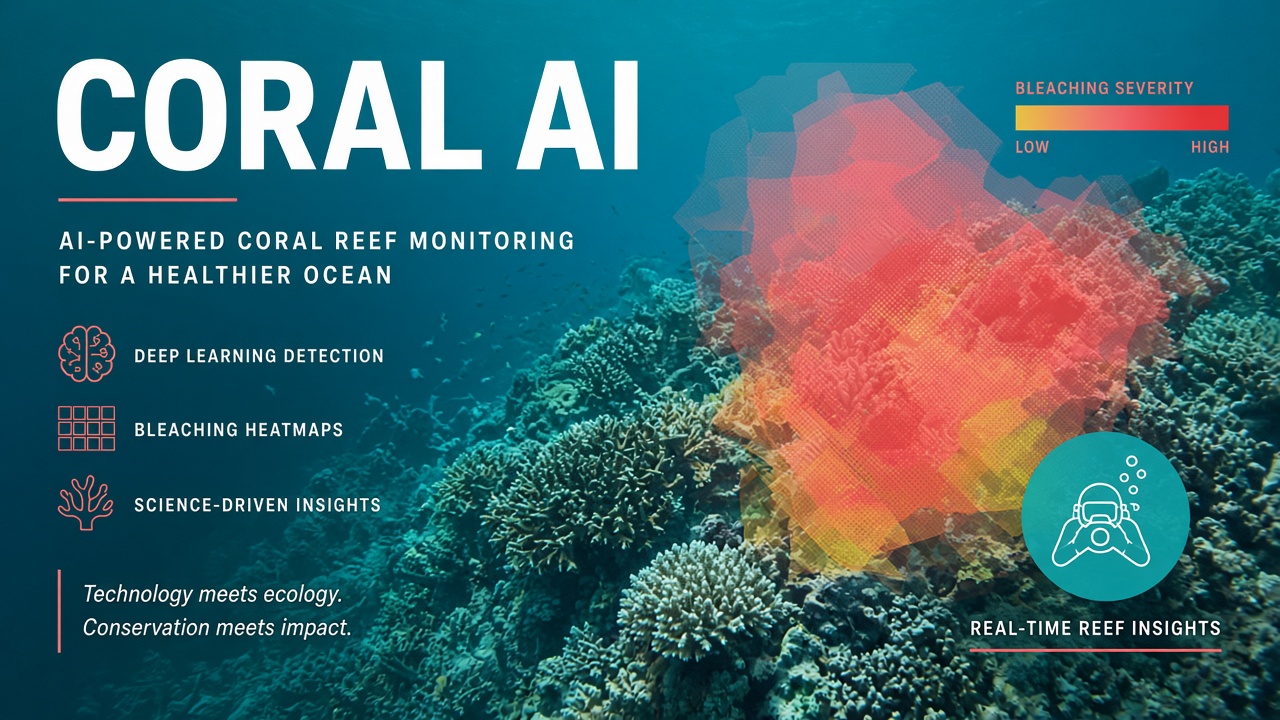
Bleaching detection classifies coral tissue states from pale partial bleaching to fully white colonies, often cross-referenced with NOAA Coral Reef Watch sea surface temperature anomalies. Color alone misleads under blue water and depth; models trained on depth-corrected images perform better. Some pipelines classify paling severity on a standardized scale aligned with Global Coral Reef Monitoring Network protocols.
Temporal comparison matters more than single-frame labels. A site flagged 10% bleached in March and 40% in May signals an acute event. AI batch scoring across seasons produces time series for marine protected area managers. Pair automated scores with random expert re-labels each quarter to catch model drift when new camera models enter the fleet.
Citizen Science Quality Assurance
Citizen science QA layers novice contributions behind training modules, gold-standard image quizzes, and expert review queues before data enters policy dashboards. Reef Check trains volunteers to count indicator fish and invertebrates along transects; photo AI can pre-screen submissions for blur, wrong angle, or missing scale reference.
- Training gate: Volunteers pass identification quizzes on known images.
- Capture validation: Automated checks reject uploads without metadata or color card.
- Model pre-label: AI suggests labels; low-confidence frames route to experts.
- Expert adjudication: Marine scientists resolve disputes and update training sets.
- Feedback loop: Volunteers see corrections to improve future captures.
Without QA, citizen science datasets inflate false trends. A single mislabeled algae bloom as bleaching can skew regional reports. Transparency about error bars builds trust with agencies consuming the data.
Policy Use and Reporting
Policy use requires aggregating validated site metrics into jurisdiction-level indicators aligned with national biodiversity reporting and marine spatial planning. UNESCO World Heritage reef sites, national park service units, and regional fisheries bodies request comparable percent live coral cover year over year. AI accelerates tabulation; legal defensibility still rests on documented methods and human sign-off.
Reports should state model version, training geography, validation accuracy, and percent of frames expert-reviewed. Link satellite heat stress from NOAA Coral Reef Watch to in-water bleaching spikes to tell a coherent climate story. Avoid presenting AI maps as AI image generator artistry; policymakers need reproducible spreadsheets and map layers in GIS formats (GeoJSON, shapefiles).
Funding bodies increasingly ask how AI reduces cost per monitored hectare. Frame ROI as faster turnaround from dive trip to dashboard, not as elimination of marine ecologists. Expert interpretation contextualizes numbers within local fishing pressure, tourism, and restoration projects.
Implementation Workflow
A practical implementation moves from pilot transect to operational monitoring in four phases.
- Pilot labeling: 500 to 1,000 expert points on CoralNet or equivalent.
- Model train and validate: Hold out 20% of sites; tune thresholds per class.
- Batch inference: Score new dives weekly; flag low-confidence for review.
- Annual report: Publish methods appendix with accuracy and coverage maps.
Data Management and Long-Term Archives
Reef monitoring programs must plan storage, backup, and model versioning before field seasons scale. A single research cruise can produce terabytes of imagery. Object storage with checksum verification prevents silent corruption. Label versions should reference which classifier produced them; re-running inference after model updates creates parallel derivatives, not overwrites. Document which derivative feeds official reports.
Open data policies benefit global science but conflict with sensitive site protections. Some governments require spatial jitter on public coordinates. AI pipelines should support redacted manifests for open release while retaining precise internal coordinates for management actions. Metadata standards from Darwin Core and OBIS improve interoperability when combining reef benthic data with fisheries or water quality series.
Training Data Governance
Models trained on CoralNet or institutional collections inherit label biases from original experts. Periodic relabeling workshops refresh categories when taxonomy updates or when new stressors (disease, predator outbreaks) need distinct classes. Include diverse annotators in adjudication to reduce single-expert blind spots. Publish confusion matrices by class, not only overall accuracy, when reporting to funders.
Integration With Restoration Projects
Coral restoration nurseries and outplant sites use the same photo workflows to measure survival and growth of fragmented colonies over months. AI segmentation tracks individual coral tags across time-lapse surveys. Restoration ROI calculations depend on reliable before-and-after cover estimates. Pair automated scores with manual quadrat sampling until models prove stable on nursery structures and artificial substrates.
Climate Communication
Public-facing reef reports benefit from clear visuals: trend lines with confidence bands, maps of bleaching extent, and plain-language captions explaining what AI did and did not measure. Avoid implying precision beyond validation data supports. Partner with local communicators so global climate narratives respect community fishing rights and tourism economies tied to healthy reefs.
Partner Coordination Across Agencies
Marine monitoring spans universities, NGOs, park services, and indigenous sea country managers; AI standardizes labels but not governance. Data sharing agreements define who may run inference, who signs reports, and how benefits return to local communities. Joint training workshops align label definitions before merging datasets from different programs. Misaligned labels produce false regional trends that undermine trust in conservation funding decisions.
Equipment Calibration Schedule
Camera firmware updates and lens changes shift color response. Maintain a calibration dive schedule: same site, same depth, same color card, quarterly. Compare AI scores before and after equipment changes on calibration sets. Retrain or fine-tune classifiers when drift exceeds agreed tolerance.
Future Directions
Emerging work combines underwater video, acoustic monitoring, and environmental DNA with photo transects for multi-modal reef health indices. AI fusion models must still trace each input to validated field methods. Autonomous underwater vehicles may collect standardized imagery at depths risky for recreational divers; human experts remain essential for ground-truthing new platforms before policy adoption.
Reef Check global datasets and CoralNet label repositories continue growing as training fuel for regional models. Contributors should understand how their annotations may feed downstream classifiers and whether credit and co-authorship policies apply when models trained on community data publish in journals.
Frequently Asked Questions
Can AI replace marine ecologists on reef surveys?
No. AI scales labeling and detects patterns in large archives. Ecologists design protocols, validate outputs, interpret stressors, and recommend interventions. Automated scoring without expert oversight risks bad policy decisions.
What is CoralNet?
CoralNet is a web platform for coral reef image annotation and machine learning classification developed at the University of California, San Diego. Teams upload images, label points, train classifiers, and run batch predictions within the same environment.
How does Reef Check fit in?
Reef Check is a global citizen science program using standardized transect methods for reef health indicators. AI tools can assist QA and data entry but do not replace its training certification for field volunteers.
How accurate is underwater reef AI?
Accuracy varies by region, label granularity, and image quality. Published studies report high agreement for broad categories (coral vs algae) and lower agreement for genus-level IDs. Always report confidence intervals on your own validation set.
How do satellite bleaching alerts relate to diver photos?
NOAA Coral Reef Watch provides early warning from sea surface temperature. Diver photos confirm whether bleaching occurred at depth and severity on the benthos. Combine both data streams in reports.
Can reef monitoring photos be shared publicly?
Check permits from marine protected areas and indigenous sea country agreements. Some sites restrict geotagged publication to prevent poaching or anchor damage. Metadata redaction may be required even when images are open.
Conservation groups building AI research partnerships should publish methods before models, allowing independent replication. Reef health is too important for black-box scores without documented training data and validation protocols.