What is BaseMap?
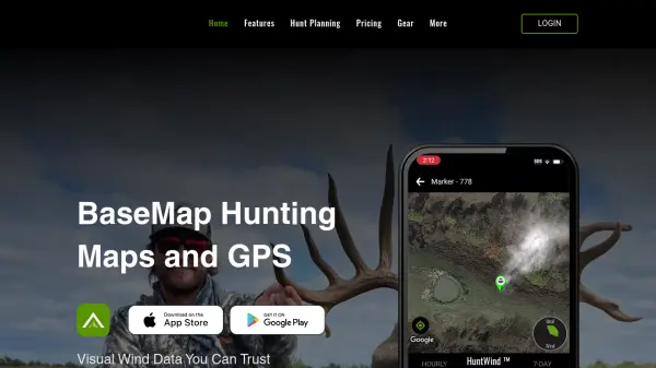
BaseMap provides hunters with a sophisticated mobile platform that combines detailed mapping, advanced planning tools, and AI-powered assistance for optimal outdoor experiences. The platform features guaranteed land ownership information with over 150 million verified parcel records and 175 million verified addresses, ensuring users can distinguish between public and private lands with confidence.
With the ARTEMIS AI Hunt Assistant, users receive intelligent recommendations for hunt planning, including draw odds analysis, harvest statistics, and unit filtering capabilities. The platform also includes specialized tools like HuntWind for wind forecasting, rangefinder mapping for target marking, and XDR navigation with built-in compass functionality. All features are accessible through a single membership that covers all 50 states, with high-speed offline maps and real-time location sharing capabilities.
Features
- Guaranteed Land Ownership: Nationwide public and private land boundaries with 150+ million verified parcel records
- ARTEMIS AI Hunt Assistant: AI-powered hunt planning with draw odds, harvest stats, and unit filtering
- HuntWind: 7-day wind forecast showing ideal, risky, and poor hunting times for specific stands
- Rangefinder Mapping: Mark distant targets using any rangefinder for game recovery and stalk planning
- Offline Maps: High-speed offline navigation using phone's built-in GPS without connectivity requirements
- XDR Navigation: Point-and-go navigation with built-in compass and rangefinder functionality
- Location Sharing: Real-time location tracking of hunting partners for safety and coordination
- Custom Markers: Add photos, hunting stands, and customize map content with colors and icons
Use Cases
- Planning hunting trips with AI-assisted draw odds and harvest statistics
- Navigating unfamiliar terrain with guaranteed land ownership information
- Determining optimal hunting times using wind forecast data
- Marking and recovering game locations with rangefinder mapping
- Coordinating with hunting partners through real-time location sharing
- Studying terrain details with high-resolution satellite imagery
- Accessing exclusive private land hunting opportunities
- Navigating offline in remote areas without cellular service