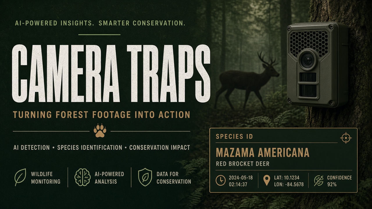
A single camera trap in a cloud forest can capture forty thousand images per year. Manual sorting once consumed graduate student semesters. Today, conservation teams deploy computer vision to filter blanks, detect animals, and propose species labels before biologists review edge cases. Wildlife Insights, MegaDetector, and SpeciesNet form the most widely cited open pipeline, with iNaturalist and citizen science layers adding geographic breadth. This guide walks from hardware deployment through model labeling, false positive management, and conservation impact measurement for programs combining AI image generator-adjacent vision tools with structured AI research workflows. AI scales surveys; it does not remove the need for ecological judgment on the ground.
How Should Teams Set Up Camera Trap Hardware?
Reliable wildlife AI starts with consistent image quality: standardized height, fixed focal zone, synchronized clocks, and metadata fields for location, habitat type, and bait use. Mount cameras on trees or stakes at knee to chest height for medium mammals, adjusting for target species. Use infrared flash modes that minimize disturbance unless study design requires white flash for pelage detail. Record GPS coordinates, compass bearing, and deployment date in a spreadsheet that travels with the SD card. Without metadata, SpeciesNet geofencing cannot suppress geographically impossible species labels.
Power and storage planning prevents mid-season gaps. Lithium battery packs extend rainy-season deployments. Label physical cards to match digital folder names. Duplicate cards before field computers ingest images to avoid single-point loss. These field habits matter because models trained on crisp, well-lit corpora degrade on fogged lenses or tilted mounts.
What Is the Standard Detection and Classification Pipeline?
The dominant two-stage pipeline runs MegaDetector to locate animals, people, and vehicles, then SpeciesNet to classify each detection to species or higher
taxonomic ranks. Wildlife Insights operationalized this ensemble inside Google Cloud, drawing on hundreds of millions of human-verified labels contributed by
the global camera trap community. Google's open-source CameraTrapAI repository documents both a fast single-detection path and a multi-detection path via
run_md_and_speciesnet for images with several species or humans plus livestock in frame.
| Stage | Tool | Output |
|---|---|---|
| Blank filtering | MegaDetector / SpeciesNet ensemble | Frames with no animal flagged for quick review |
| Object detection | MegaDetector v5 | Bounding boxes: animal, person, vehicle |
| Species classification | SpeciesNet | Top-5 labels with confidence per crop |
| Human verification | Wildlife Insights UI or custom QA | Confirmed labels feed retraining |
How Do Teams Label Data and Retrain Responsibly?
Start from platform pre-labels, route low-confidence and rare-species images to expert reviewers, and feed verified labels back into training corpora with documented taxonomy choices. SpeciesNet recognizes roughly 2,500 categories including species and higher taxa. When the model is confident at genus but not species, Wildlife Insights surfaces the higher rank rather than guessing a specific epithet. That rollup behavior reduces flashy but wrong species counts in reports.
- Upload batches with country and admin1 region for geofencing.
- Auto-run MegaDetector plus SpeciesNet locally or in Wildlife Insights.
- Sort by ascending confidence to prioritize human review time.
- Tag difficult pairs (coyote vs. domestic dog, leopard vs. ocelot) for specialist queues.
- Export verified labels in standard JSON for occupancy modeling.
- Contribute anonymized images to community training pools when permits allow.
Local execution suits remote projects with bandwidth limits. Install MegaDetector and SpeciesNet via pip, then run batch scripts on a GPU workstation. Google's research blog notes SpeciesNet can process tens of thousands of images per day on a laptop CPU and far more on a modest GPU. Plan storage for cropped detections when using the multi-animal path.
What Performance Should Teams Expect from SpeciesNet?
Google's 2024 publication and research blog describe training on tens of millions of images with held-out project evaluations. Animal detection recall on test projects reached roughly 99 percent in favorable conditions, with species-level accuracy in the mid-80 percent range when the model committed to a species label, and higher taxonomic rollup when species confidence was low. Real-world projects with novel camera brands, atypical bait setups, or understudied species should expect lower numbers until local verification data accrues. Treat published benchmarks as ceilings, not field guarantees.
How Do False Positives Appear in Species ID?
Common failure modes include confusing morphologically similar species, mislabeling partial animals at frame edges, classifying humans or livestock as wildlife, and accepting geographically implausible species when geofencing is disabled. Published evaluations report high animal detection recall on held-out projects, with species-level accuracy varying by region and training representation. Rare species with few training images remain vulnerable to forced assignments. Motion blur from fast ungulates or small rodents at night produces empty or generic labels.
Mitigations combine technical and procedural controls. Enable geofencing with accurate deployment coordinates. Use detection confidence thresholds that trade recall for precision when publishing population trends. Maintain a project-specific exclusion list for known trigger-happy classes (cattle, staff, vehicle glare). For occupancy models, treat AI labels as initial priors and require minimum human verification rates on stratified random samples before citing results in management plans.
How Do iNaturalist and Wildlife Insights Complement Each Other?
Wildlife Insights optimizes for high-volume passive camera sequences; iNaturalist optimizes for opportunistic observations with community validation. Projects can export uncertain SpeciesNet crops to iNaturalist for crowd review when species are rare or newly arrived in a region. Conversely, iNaturalist occurrence records inform whether a proposed species label is geographically plausible before biologists open the full-resolution trap image. The bridge works when taxonomic standards align and when coordinators communicate licensing: trap images may include research permits that restrict public sharing even when species IDs are safe to publish.
How Does Citizen Science Integrate with Camera Trap AI?
iNaturalist and Wildlife Insights community uploads expand training diversity, while structured volunteer review corrects model errors on iconic and invasive species. iNaturalist Computer Vision suggestions help naturalists identify single photos; camera trap projects differ because sequences capture behavior over time. Still, iNaturalist observations improve regional species priors and alert managers to range shifts visible before formal trap grids update.
Citizen science layers work best with clear instructions: photograph only when permits allow, obscure exact poaching-sensitive coordinates in public exports, and use standardized vocabularies for habitat tags. Pair volunteer enthusiasm with biologist sign-off on any AI-assisted population estimate cited to funders or governments.
How Do AI Labels Feed Occupancy and Population Models?
Species labels from camera traps typically feed occupancy-detection models that estimate probability of site use while accounting for imperfect detection. AI pre-labels reduce manual effort but introduce false presence or false absence if verification is thin. Best practice runs double-observer or distance sampling protocols on a subset of grids to estimate error rates, then applies bias corrections in R packages such as unmarked or camtrapR. Seasonal comparisons require consistent effort: if AI blank-filtering becomes more aggressive in year two, apparent declines may reflect pipeline change, not ecology. Document model and threshold versions in every annual report.
What Conservation Impact Can AI-Assisted Surveys Deliver?
Faster labeling translates into timelier occupancy trends, earlier invasive species detection, and more budget left for field interventions instead of spreadsheet labor. Protected area managers use camera trap indices to allocate ranger patrols. Connectivity studies merge AI-labeled corridor cameras with genetic sampling. Climate adaptation projects compare elevational range shifts year over year when processing pipelines keep pace with image volume.
Impact documentation should cite verification rates and confidence intervals, not raw model counts. A 30 percent speedup that introduces 5 percent species error can still be valuable if errors are random and audited. Systematic bias (misclassifying all melanic individuals, for example) can invert management decisions. Build QA dashboards that track error types over seasons.
Field Deployment Checklist
Before leaving for the field season, teams should confirm camera firmware, SD card capacity, GPS datum alignment with GIS layers, species list coverage in SpeciesNet for the target biome, and data-sharing agreements with park authorities. After retrieval, hash image folders to detect corruption, run MegaDetector overnight on a local GPU, and import only summary statistics to cloud dashboards when bandwidth is costly. Train new volunteers on the difference between "animal detected" and "species confirmed" to prevent enthusiasm-driven mislabels in iNaturalist cross-posts.
Frequently Asked Questions
Should we use Wildlife Insights or run models locally?
Wildlife Insights offers cloud storage, collaborative review, and automatic model updates, ideal for multi-partner projects. Local runs suit sensitive locations, air-gapped reserves, or custom fine-tuning on proprietary datasets. Many teams hybridize: local inference, cloud review.
Is MegaDetector enough without SpeciesNet?
MegaDetector alone answers "animal present?" not "which species?" For diversity metrics you need a classifier stage. MegaDetector remains valuable to strip blanks before expensive species models run.
How do we handle multi-species frames?
Use the MegaDetector plus SpeciesNet multi-detection script rather than the default highest-confidence-only path. Each bounding box receives its own species hypothesis. Reviewers confirm interactions like predator-prey pairs separately.
Does iNaturalist data train SpeciesNet?
SpeciesNet training draws on Wildlife Insights community data and other curated repositories. iNaturalist contributes adjacent biodiversity signal. Contributing verified trap data to Wildlife Insights directly improves future model versions for your region.
Can we publish results using AI labels only?
Journals increasingly expect explicit human verification protocols. Report model version, geofencing settings, reviewer sample size, and error rates. Raw AI counts without QA are suitable for internal triage, not final conservation statistics.
Can models run on edge devices in the field?
Lightweight detectors can run on Raspberry Pi-class hardware for real-time blank filtering at upload hubs, reducing cloud costs. Species classification still benefits from GPU servers or Wildlife Insights cloud for model updates. Test battery draw and heat before leaving devices unattended in tropical field stations.
How do teams protect location data for endangered species?
Obfuscate or delay public coordinates for poaching-sensitive species. Restrict map layers in collaborative platforms to role-based access. AI does not remove the need for data sensitivity reviews before every export to open databases.
AI for wildlife monitoring turns camera trap floods into structured biodiversity signals when MegaDetector and SpeciesNet sit inside a verification culture. Deploy cameras carefully, label with geographic context, challenge false positives, and feed confirmed data back to the models that serve the next season's survey.