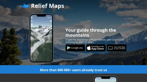

What is Relief Maps?
Relief Maps is a 3D mapping application designed to help users travel through mountains with confidence. It provides reliable and easy-to-read 3D maps, enabling users to create routes quickly with estimates for distance, altitude difference, and required time, which is ideal for hiking and trekking activities.
The application includes a database of over 1 million nearby routes to ensure users never run out of ideas. It also features live tracking to share real-time positions with relatives for safety. Created in Annecy, France, Relief Maps focuses on delivering a quality tool that remains easy to use, with content available in both English and French.
Features
- 3D Maps: Provides reliable and easy-to-read 3D maps for mountain travel
- Route Creation: Estimates distance, altitude difference, and time for hiking and trekking routes
- Route Database: Offers access to over 1 million nearby routes
- Live Tracking: Shares real-time position with relatives for safety
- Multi-language Support: Available in English and French
Use Cases
- Planning hiking and trekking routes in mountains
- Discovering new mountain routes from a large database
- Ensuring safety during mountain travel with live tracking
- Estimating travel time and altitude changes for outdoor activities