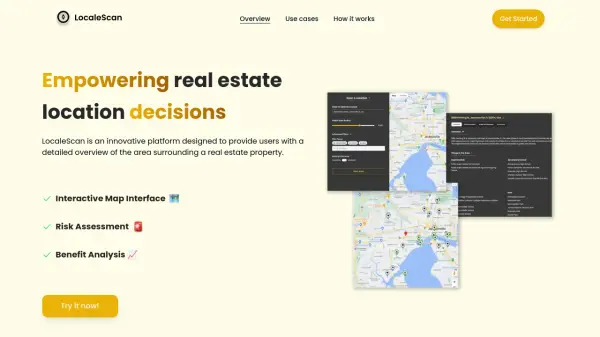
What is LocaleScan?
LocaleScan is an innovative platform designed to provide users with a detailed overview of the area surrounding a real estate property. It offers an interactive map interface and uses AI to help users navigate property prospects with confidence.
The platform provides a comprehensive risk assessment, including up-to-date crime statistics, environmental hazard details (noise and pollution levels, proximity to highways and industrial sites), and economic stability evaluations. It also offers a benefit analysis, highlighting local amenities, educational institutions, and childcare facilities.
Features
- Interactive Map Interface: User-friendly map to explore surrounding area information.
- Customizable Markers: Different icons represent various place types (schools, hospitals, etc.).
- Risk Assessment: Statistics on crime, environmental hazards, and economic stability.
- Benefit Analysis: Information on local amenities, education, and childcare.
- Economic Stability: Evaluation of the area's economic health, including unemployment rates, economic growth and opportunities.
Use Cases
- Assess neighborhood safety and suitability before purchasing a home.
- Evaluate rental properties based on location pros and cons.
- Identify high-potential investment areas.
- Provide clients with data-driven property insights.
- Understand conditions and challenges of development sites.