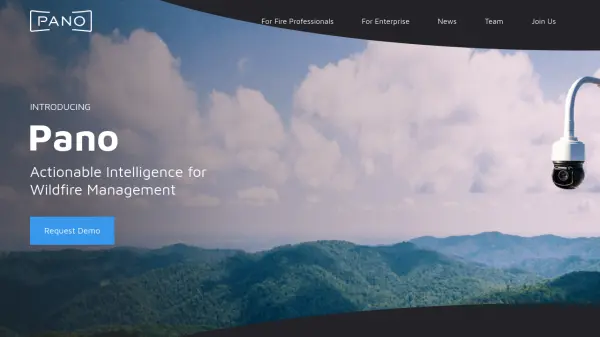
What is Pano AI?
This platform delivers actionable intelligence crucial for wildfire management, addressing the critical challenge of reducing response times to potential infernos. By integrating networks of ultra-high-definition, 360-degree cameras (Pano Stations) with AI-driven analysis, satellite data, and emergency alerts into a unified view, it empowers detection specialists and first responders. The system continuously scans landscapes, using deep learning and computer vision to automatically detect, verify, and classify potential wildfire events in real-time.
Upon detecting a threat from any source, the platform automatically alerts fire monitoring professionals, providing intelligent, auto-centered images with enhanced zoom capabilities for rapid confirmation and precise triangulation of the fire's location. Confirmed information, including up-to-date time-lapse imagery and details on fire movement, is quickly disseminated to extended teams and first responders via built-in alerts and mobile notifications. This comprehensive approach enhances situational awareness, improving the accuracy and control of wildfire response efforts to protect lives, property, and natural resources.
Upon detecting a threat from any source, the platform automatically alerts fire monitoring professionals, providing intelligent, auto-centered images with enhanced zoom capabilities for rapid confirmation and precise triangulation of the fire's location. Confirmed information, including up-to-date time-lapse imagery and details on fire movement, is quickly disseminated to extended teams and first responders via built-in alerts and mobile notifications. This comprehensive approach enhances situational awareness, improving the accuracy and control of wildfire response efforts to protect lives, property, and natural resources.
Features
- Pano Stations: Network of continuously scanning, 360-degree, ultra-high-definition cameras deployed on high vantage points.
- AI-Powered Detection: Uses deep learning and computer vision for automatic, real-time wildfire detection, verification, and classification.
- Rapid Confirmation Tools: Provides auto-centered images, enhanced zoom, and triangulation for quick fire validation and location pinpointing.
- Unified Data Integration: Combines camera feeds, satellite data, emergency alerts, and other sources into a single interface.
- Real-time Information Dissemination: Shares alerts, mobile notifications, time-lapse imagery, and key fire data with response teams.
Use Cases
- Detecting wildfires in their early stages across vast landscapes.
- Confirming the exact location and size of reported fires quickly.
- Providing real-time situational awareness to fire agencies and first responders.
- Monitoring high-risk areas for utilities, resorts, and private landowners.
- Improving wildfire response coordination and resource dispatch.
- Assisting insurance companies in assessing wildfire risk and impact.